I-70 closed at Topeka both directions
 Trucker Route: Road conditions511 closure and chain alerts
Follow the closure, not the whole highway.
Trucker Route puts state 511 road reports, National Weather Service warnings and mountain pass conditions on one map for truck drivers in the United States. Follow the passes, highways and places you drive, and we tell you when they close, need chains or get a weather warning.

- Free
- 5.0 rating on the App Store
- iPhone, iPad and Mac
Try it: follow the I-70 closure
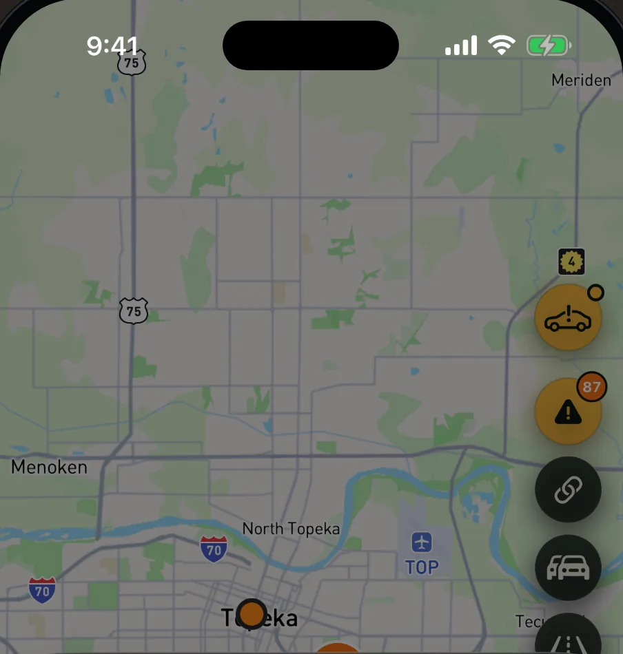

Road closure
I-70
Both directions · Kansas
Dangerous to drive now
Checked at 3:05 PM. Closed.
I-70 in both directions: Road closed between US 75 and US 40 in Topeka.
Severity
Extreme · 5 of 5
Direction
Both directions
Tap Follow to try it. The app checks road feeds every 15 minutes; here an hour of checks takes a few seconds.
Inside the app
The same 10 screens you see on the App Store. Tap one to look closer.
Alerts for the roads you drive
Sign in with Apple, Google or your email, then follow what you drive. For a highway or an area, you pick which of 17 alert types you want, such as:
- Closures
- Reopenings
- Ice
- Chain controls
- Tornado warnings
- Winter storm warnings
- High wind warnings
- Flash flood warnings
-
A mountain pass
You get a push when it closes, reopens or chains go on.
-
A highway in the states you pick
Such as I-80 in Wyoming and Nebraska. About 400 Interstates and US highways are on the list.
-
An area around a place
10 to 200 miles around your location, a place you search for or a spot you long-press on the map.
-
One road report
Open a closure or a major crash, tap Follow, and we tell you when it reopens or clears. The follow ends on its own once the report is over.
- Push, and email if you want itAlerts come as a push notification, and by email if you want them there too.
- One inboxEvery alert also lands in Notifications in your account.
- Every 15 minutesRoad feeds and weather warnings are checked every 15 minutes.
- One push per checkSeveral alerts from one check arrive as one push.
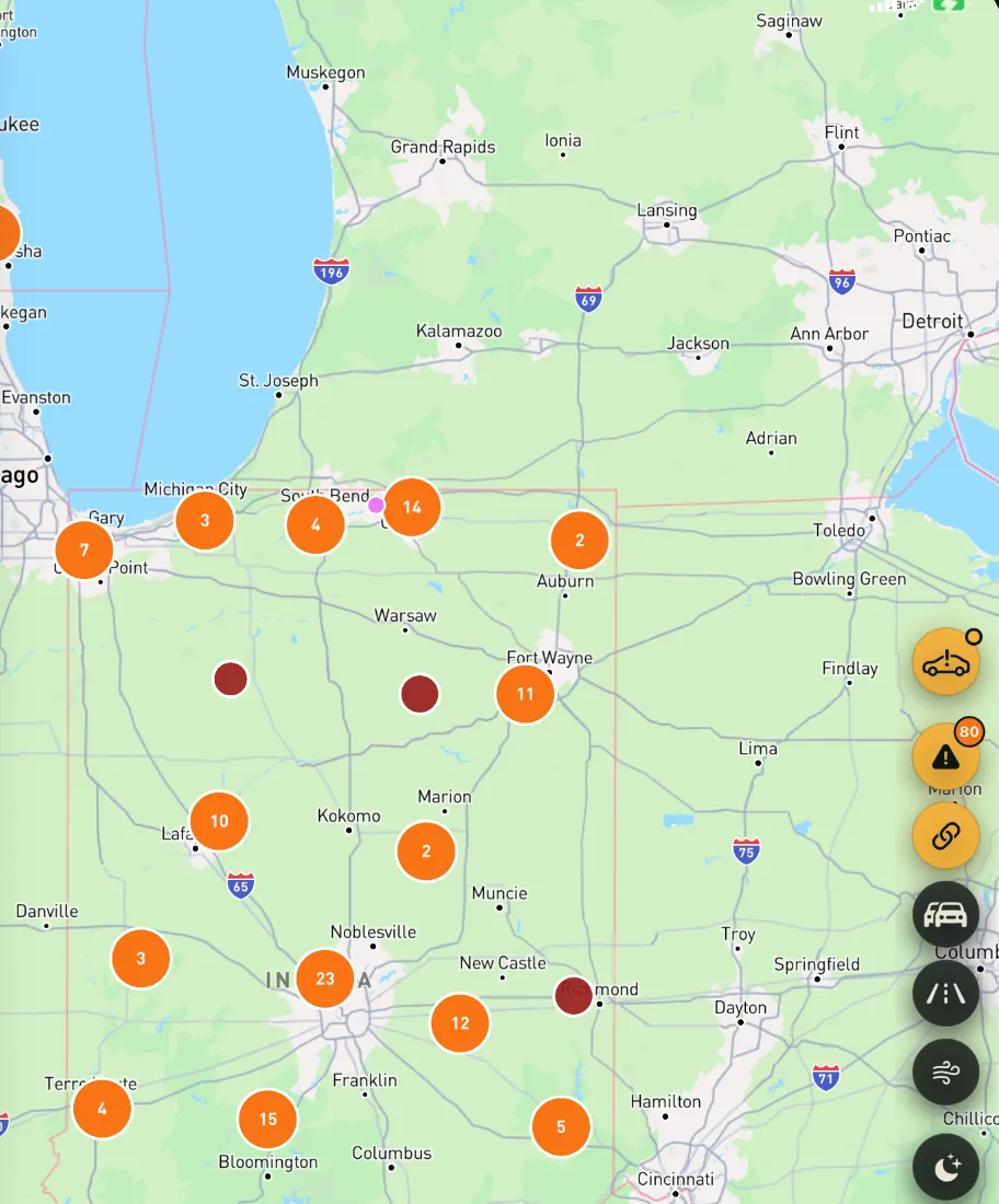
What is on the map
Filters narrow the map to what slows a truck, to reports that block at least half the lanes, or to Interstates. Road reports and weather warnings have a share link.
-
Road reports from 41 states
State DOT 511 and traffic feeds: closures, crashes, work zones, chain controls and weather-related reports. Six more states send work zones only.
-
Weather warnings
National Weather Service watches, warnings and advisories, colored by severity. Ice has its own color and symbol.
-
Dangerous to drive right now
The map pulses where it is dangerous to drive right now: ice on the road, blizzards and winter storm warnings, tornado warnings, severe thunderstorms with 1.75-inch hail or 70 mph gusts, and full closures.
-
Mountain passes
Marked open, chains or closed, from state DOT reports.
-
High wind and blow-over zones
NWS wind warnings plus stretches known for crosswinds, such as I-80 at Elk Mountain, Wyoming.
-
Wildfires and smoke
Hotspots from NASA FIRMS, fire perimeters from NIFC and smoke from NOAA.
-
Earthquakes, rivers and disasters
Earthquakes of magnitude 2.5 and up from USGS, NOAA river gauges and active FEMA disaster declarations.
-
Traffic and forecast
Live traffic and weather forecast points.
Fire and flood data refresh about once an hour. A feed can be late or miss an event, so road signs and officers on scene come first.
Plan a route
The Route tab lists the hazards along your route in order of distance and checks it against the low bridges, weight postings and truck-restricted roads in our data, for a standard 53-foot semi. From October through April it also names the chain-law states the route enters.
The route comes from a regular road routing engine, not a truck router, and restriction data is not complete for every road.
Posted signs and your permits come first
- Hazards along the route, nearest first
- Low bridges
- Weight postings
- Truck-restricted roads
- Chain-law states, October through April
Rules by state
Local Rules
Truck rules for the state you are in or any state you pick, such as speed limits, lane restrictions, idling, move-over, weight, phone use, frost laws and work zones, grouped by what they ask of you. Long-press the map to see the rules at that spot.
Chain Laws
All 50 states and DC, searchable, each state on its own page.
Interstates and statistics
25 major Interstates with their shields, and trucking statistics by state from FMCSA, FHWA and NHTSA.
New in version 1.4
1.4.0 Released October 26, 2026
Alerts for the roads you drive.
- Sign in and follow. Sign in with Apple, Google or your email, and follow mountain passes, highways in the states you pick, and areas around a place. You get a push notification when they close, need chains or get a weather warning.
- Follow one closure or major crash. We tell you when it reopens or clears, then the follow ends on its own.
- The map pulses where it is dangerous to drive right now, and ice has its own color.
- Detail sheets put alerts near the top and have a share link.
- Local Rules groups each state’s rules by what they ask of you.
- Chain Laws covers every state and DC, with search.
- The app has a new icon.
Every release so far
- 1.4.0Alerts for the roads you drive, and a new icon.
- 1.3.0Animated radar, search, a route safety check for low bridges and weight postings, rebuilt map controls.
- 1.2.0Local Rules, long-press for state rules, light and dark maps, the “Only what slows a truck” filter.
- 1.1.0511 incidents from 40+ states, NWS alerts, pass chain status, wildfires, earthquakes and state dashboards.
- 1.0.2Fixes for pop-up windows.
- 1.0.1A My Location button to center the map on you.
- 1.0First release on the App Store.

Data Not Linked to You
That is the App Store privacy label for Trucker Route. Location, a device ID and other data may be collected, and none of it is linked to who you are. The map and the rules work without an account; you sign in only to follow roads and get alerts.
- Location
- Identifiers
- Other Data
Also on the web
The same live map runs in the browser at trucker-route.com, with state pages, truck laws and mountain pass guides. The website has its own case study.
Details
- Price
- Free
- Version
- 1.4.0, October 26, 2026
- Size
- 89.4 MB
- Category
- Navigation
- Age rating
- 4+
- Seller
- Sergei Kulnev
- iPhone
- iOS 17.0 or later
- iPad
- iPadOS 17.0 or later
- Mac
- macOS 14.0 or later, Apple M1 chip or later
- Apple Vision Pro
- visionOS 1.0 or later
- Copyright
- © 2026 Trucker Route
- Support
- trucker-route.com/about
Follow your first road.
Free on the App Store for iPhone, iPad and Mac.